Skitourenführer Allgäuer Alpen
Scope and coverage
Kristian Rath’s guide gathers the Allgäu Alps’ classic and lesser‑known ski‑mountaineering lines into one cohesive volume, spanning the foothills above Immenstadt and Sonthofen to the higher Allgäu main ridge and across the borders into Kleinwalsertal and the Tannheimer Tal. Coverage is broad and well balanced: easy powder meadows on peaks like Grünten, Riedberger Horn and Reuter Wanne; intermediate days on Hochgrat, Güntlespitze or Ponten; and committing outings on Kleiner/Größer Daumen, Mädelegabel, Hohes Licht, Großer Wilder and Widderstein. A curated section of weekend linkups rounds it out.
Structure and usability
The front matter is unusually thorough for a ski guide: how to use the book, grading, avalanche considerations, timing, GPS, access and transport, emergency numbers, and conservation. Regions A–L follow a clear template with an overview map, approach notes (including public transport and parking), hut options, then tour chapters. Each itinerary lists elevation gain, grade (L/WS/ZS/S), aspects, distance and time, and is supported by an action photo and a clean route sketch. A back‑of‑book “Übersicht der Ziele” consolidates the entire catalogue in sortable tables with page references—excellent for quick planning. A download code provides GPX tracks, and recommended DAV ski‑tour maps (BY01–BY05) are specified.
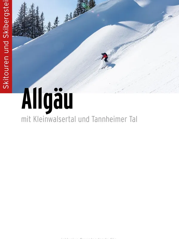
On‑mountain detail
Rath writes like a local who has skied these hills for decades. Descriptions are concise but field‑savvy, highlighting steep forest entries typical of the Ostrachtal, wind‑affected ridges, and when booting or light crampons help (e.g., Kleiner Daumen via the Hindelanger Klettersteig). Aspect flags and seasonal notes are practical for finding safe, powder‑holding terrain. Short natural‑history sidebars and a strong photo selection add a sense of place without bloating the text.
Limitations
Mapping is schematic rather than full topographic, so pairing the book with the cited AV/DAV maps (or the GPX) is wise. Grading abbreviations are well explained up front, but first‑time visitors should read that section carefully before choosing objectives.
Recommendation
A benchmark ski‑touring reference for the Allgäu Alps. Beginners will appreciate the forgiving Vorberge selections; ambitious skiers get a deep bench of serious lines on the main ridge; and everyone benefits from the planning tables and GPX support. If you are skiing the Allgäu, Kleinwalsertal or Tannheimer Tal from December to spring, this is the one guide to carry.
Details
Extract- Activity
- Ski Touring
- Authors
- Kristian Rath
- Weight
- 510g
- Pages
- 264
- ISBN
- 978-3-95611-183-9
- Publisher
- Panico Alpinverlag